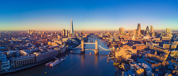
London is one of the most well-known cities around the world, it is the capital of England and a huge tourist attraction. If you’ve ever visited/or live in London, you’ll know that there’s always work going on around the City.
Whether that’s new buildings, building repairs, extensions, roads, railway work etc. The opportunity and need for a 3D Laser Survey are extremely high within London.
For more information about 3D laser scanning and how it works please visit our 3D laser scanning page
At Scantech International we have carried out numerous of 3D Laser Surveys in and around London. Some of the key landmark areas we have done are London Underground, Electrical tunnels, £15,000,000 House located in Knightsbridge and hundreds of railways surveys within the M25.
Some of the surveys we have carried out in London are:
We created Revit models of houses based within the M25 using laser scanning and drones surveying. We could survey around 3 houses per day from top to bottom. Capturing roofs, lofts, windows, joists, walls, basements and any other major features.
We have carried out numerous jobs on the London Underground. This includes tunnels, monitoring, stations and alignment surveys.
One of our biggest London Underground jobs was for the Olympics where a new lift was needed in Green Park station. We had to survey the whole station and the above-ground, create accurate 3D models so they could design where the new shaft was going.
We have worked in some very nice houses in London for architects. On this one in Knightsbridge, we produced a 3D laser survey in the colour of the entire house and placed GPS points on the roads to complete the survey to an OS Grid.
The architecture needed the survey to a 5mm accuracy for the plans to re-renovate the building to ensure he was within the rights of light with his new build plans.
A big problem for most buildings in London is knowing what is underneath them before they start building. With so many tunnels below London, you need to monitor them to make sure the pilling doesn’t affect or damage the tunnel below.
To do this we placed SCCS wall monitors on top of the tunnel every 3-5 metres in the worksite which was approximately 250-400 metres long. All wall monitors were connected up to the main controller at the start of the tunnel which will take several readings throughout the day so we’ll be able to analyse the data and see if the tunnel is dropping height by a few millimetres in the 10 years we’re analysing the readings.
On top of that, we also carry out 3D laser scans of the tunnel every 6 months. Then take sections through the point cloud data and compare to see if there’s any visible movement.
If you would like any 3D, topographical or measured building surveys in London doing please get in touch today via:

“We would like to thank you for your efforts delivering the topographic survey and 3D pointcloud survey for the 82 span, 1200m long Harringworth Viaduct recently.To complete the works for such a structure in the limited time available in the possessions was fantastic. We also appreciate your flexibility in rescheduling the works at short notice due to problems with the possession booking.We are now creating the elevations and sections for the viaduct and would like to thank you for the quality of your deliverables and your availability for ongoing discussions with our CAD team”.

“Morgan Sindall Professional Services were appointed by London Underground to provide a multi discipline design service for the upgrade of the ventilation system as part of the Victoria Line cooling the tube programme. The ventilation shafts are only available during a series of 4 hour engineering hour slots which requires 28 days notice before access is granted. The quality of the panoramic images provided by Scantech International Ltd allow the Client, Design Engineers and Contractor to constantly view and reference the complete infrastructure with out the need for repeat site visits, saving considerable time and money and maintaining confidence as the design develops and evolves “