Home > Case Studies > Llandudno
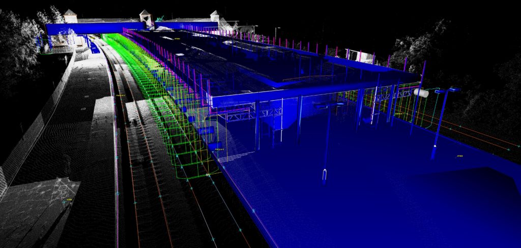
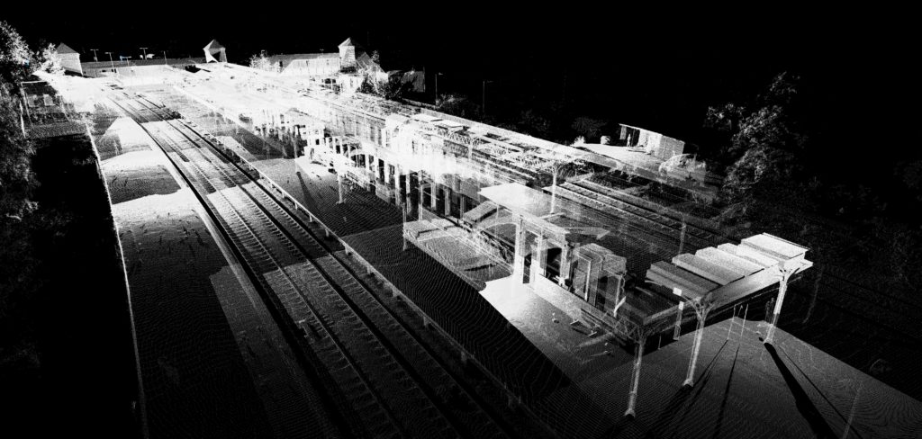
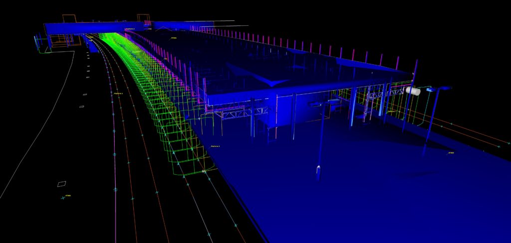
Below is an image of a point cloud and 3D AutoCAD Model combined together of Llandudno Junction Train station, a survey which Scantech International carried out in 2018 using state of the art laser scanning.
Amco Rail – Amco carries out many projects across the railway infrastructure including civil, mechanical, maintenance and engineering for Network Rail.
We have worked with Amco for over 10 years providing them with high quality and accurate point cloud data and other deliverables on the railway throughout the UK.
Llandudno Junction Station is about to undergo a major refurbishment, to keep the station operating normally during the refurbishment any temporary structures (such as scaffolding) are required to remain clear of any trains within the specification laid out by Network Rail (NR_L3_TRK_2049).
Here are the deliverables of the project:
Supplied as an AutoDESK ReCAP file and orientated to OS.
We had over 100 individual scans for this project, each scan is then registered together to create one overall ‘3D point cloud’.
3D Pointclouds can then be used to create the following:
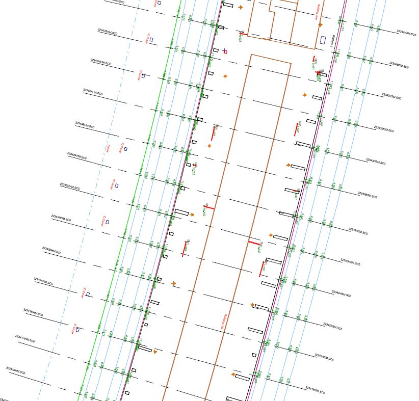
Topographical surveys are an accurate representation of an area in 2D. This 2D topographical drawings help the designers know where everything is to help aid with their design.
3D AutoCAD models are created from applying surfaces to the point cloud. Once all surfaces have been applied, you have an accurate 3D AutoCAD model which helps the client in their design.
The proposed scaffolding design was also superimposed on to the model/point cloud so that any potential ‘snags’ (such as any clashes with existing station objects) could be identified and rectified prior to any site works commencing.
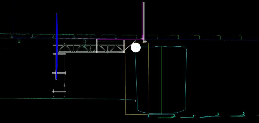
ClearRoute analysis was carried out in accordance with the requirements set out within NR_L3_TRK_2049. This helps identify if there would be any collisions with trains at the design stage which is vitally important.
Spherical panoramas from each scan position linked to a plan of the station (as a PDF).
nbsp;