We undertook a 3d Laser survey and created a 3D Revit model of Anderton Boat Lift in 2018.
The Anderton Boat Lift is a scheduled ancient monument and is the only boat lift of its type in the UK.
It was restored to working order in 2000 using a modern hydraulic system to move the caissons rather than the previous arrangement of electrically worked winches (which remain in situ as part of the heritage of the site).
The control system installed at that time used Allen Bradley PLCs and associated I/O, control network and SCADA system. That control system was approaching life expired, with reliability issues affecting the operation of the lift; primarily because of the poor condition of much of the field equipment and associated cabling.
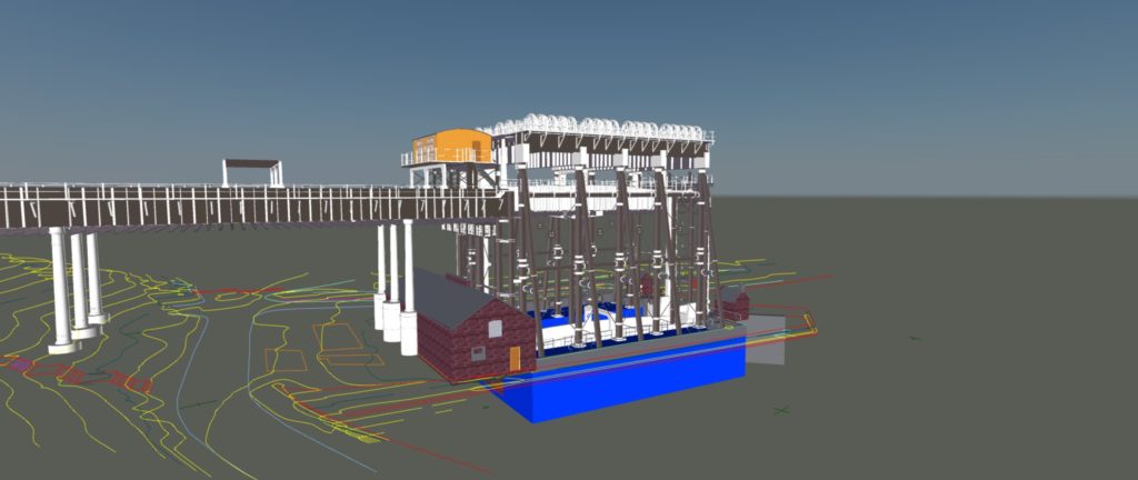
In order to bring control system and its associated equipment and cabling up to the required standard a site survey was required of the boat lift structure, lifting system, canal aqueducts, associated ground level structures and the surrounding ground levels, including river and canal banks to produce a 3D model to BIM LOD4 level of detail.
The model was also to be used to demonstrate to Historic England how the new control system will maintain the historic integrity of the structure
After a competitive tender Amco asked Scantech to carry out the laser scanning survey of the Boat Lift to produce the 3D BIM model. We won this work on the basis of :
The Boat Lift is in almost constant use and therefore the time available to carry out the survey was extremely limited and required working by water.
To overcome these issues we utilised our Faro laser scanner to capture as much of the structure as possible from the ground and platforms and to complete the survey we used our UAV to capture the areas not visible/accessible to the scanner.
We also used our iStar camera again on the ground to take panoramic HDR photographs which were used to colourise the pointcloud data. This had the added advantage over the built-in scanner camera that we could carry out the scanning and photography in half the time.
We set out control points around the site and coordinated these with the EDM and subsequently orientated them to OS using GPS.
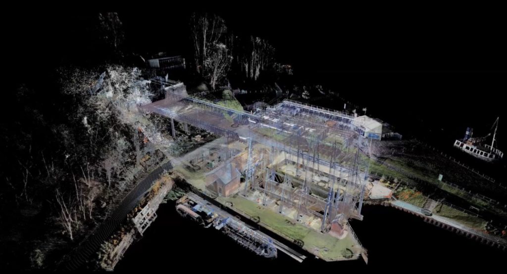
Once all the scanning was completed the individual scans were registered together to produce an overall pointcloud of the structure referenced to OS coordinates.
Detailed notes and photographs were taken to assist in the production of the 3D model in Revit which was produced from the registered pointcloud.